The First Inhabitants
Updated: Jun 28
Native Americans in Chester County and Sadsbury Township
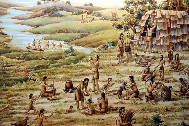
Archeological evidence indicates that Native American tribes inhabited our area centuries before the Europeans arrived. There may have been thirty to forty tribes living along the waterways of Chester County, usually found in scattered tribes living in some river or creek valley. They called themselves “Lenni Lenape,” which in their language meant simply “common people” (later English settlers would call them the “Delawares” after the river they lived near).
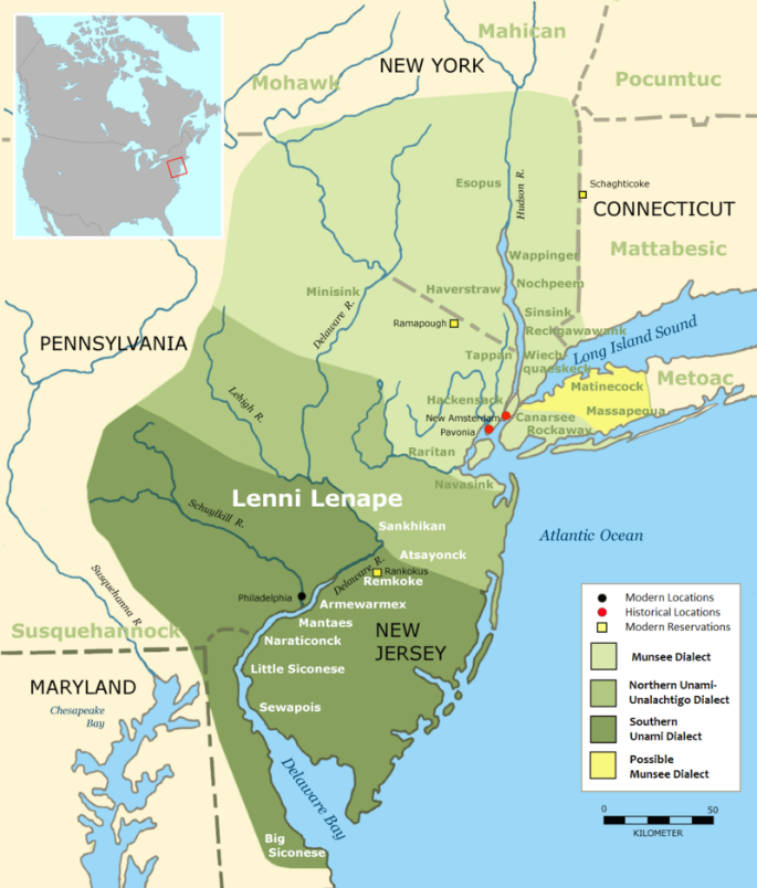
The word “Lenapehoking” is widely translated as 'Homelands of the Lenape', which in the 16th and 17th centuries ranged along the Eastern seaboard from western Connecticut to Delaware and encompassed the territory adjacent to the Delaware and lower Hudson River valleys, and the territory between them. The Lenape in Chester County spoke the Unami dialect of the Algonquian language.
In 1681, King Charles II granted a large piece of his North American land holdings along the North Atlantic Ocean coast to William Penn, a Quaker, to offset debts he owed Penn's father. The land included the present-day states of Pennsylvania and Delaware. Penn established an Indian policy based on the religious principles of the Society of Friends (the Quakers). His method was to purchase lands from the leaders of the indigenous settlements and then resell them to European settlers.

After his death in 1718, Penn’s heirs and followers abandoned his aspiration of dealing fairly with the Lenape in favor of the objectives of wealth and expansion. Despite William Penn’s personal promise to the Brandywine Lenape that their land claims along the river would be honored as long as they continued to reside there, his sons and followers continued to parcel and plot lands still occupied by the Lenape peoples. This led to both the legal and illegal acquisition of all Lenape lands in southeastern Pennsylvania. The majority of the Brandywine Lenapes reluctantly abandoned their ancestral home because Chester County settlers refused to honor the terms of William Penn’s treaty with local Lenape bands.
In 1737, the infamous Walking Purchase resulted in the Penn family acquiring approximately 1,200,000 acres from the Lenape. This treaty with the Lenape supposedly promised to sell land that started at what today is Easton, Pennsylvania as far west as a man could walk in a day and a half. When the heirs of Penn decided to enforce this treaty, they hired three men to take turns running along a prepared path which resulted in claiming 30 miles more than the Lenape had predicted that a man could walk in a day and a half. Lenape chief Lappawinsoe and others contested the results of this “walking” purchase. The settling of these lands and others by Europeans eventually led the Lenape to move west; first to western Pennsylvania and then to Ohio, Canada, and Oklahoma where many live today.

Hannah Freeman, popularly known as “Indian Hannah”, is remembered in local lore as the last Lenni Lenape living in Chester County at the time of her death in 1802. Modern historians now know that many individuals of Lenape descent live in or near the traditional Lenape homeland in Pennsylvania, Delaware, New Jersey and Maryland. The massive immigration of Europeans forced the pockets of Lenape that remained in the region in the 18th century to either relocate or assimilate, obscuring many of the cultural and physical markers that signaled their presence.
The Major Indian Trails in Western Chester County
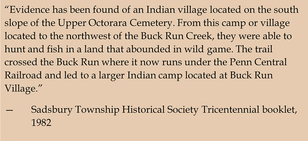
It is generally not possible to walk an old Indian path in Pennsylvania today as most traces have been obliterated by farming, lumbering, roadmaking, etc. However, historians have mapped old Indian paths using a variety of sources including traveler’s journals, archaeologist findings, land warrants, contour maps, and reminiscences of old-timers. While there are few documented Native American settlements in or around Sadsbury, there are several Indian trails that passed through our area:

The Great Minquas Path was named by the Dutch for the Minquas Indians (the Susquehannocks), from whose territory on the Susquehanna River this path ran to the Philadelphia-Chester area. The Susquehannock used this path as an alternate to their canoe route to bring furs to the Dutch and Swedish. Over this path, the Susquehannock brought great wealth in beaver skins to the eastern trading posts, and the Minquas Path laid the foundation for Pennsylvania’s commercial development. Strasburg Road in Chester County and Lancaster County generally follows the route of the Great Minquas Path.
After the Nanticoke Indians settled on the north branch of the Susquehanna River, they used the Nanticoke Path to return seasonally to their old haunts on the Eastern Shore in Maryland to fish and feast on shellfish. It is believed that this path was later incorporated into what is now Route 10.
Old Peter’s Road was laid out in 1718 on a bridle path previously established by Peter Bezaillon, a French explorer and fur trader. This path followed an old Indian path and journeyed east from Bainbridge (near Elizabethtown) to Chester County. For a while, it was considered the main route between Philadelphia and the west. Today, U.S. Route 30, PA Route 340, PA Route 897, PA Route 283, and PA Route 230 all follow parts of Old Peter's Road.
Sources:
Indian Paths of Pennsylvania, Paul A.W. Wallace,1965.
Locust Grove Schoolhouse website http://locustgroveschoolhouse.org/articles/indian-history#
Official Web Site of The Delaware Tribe of Indians https://delawaretribe.org/
The Original People – The Lenni Lenape by Paul Mullin, Westtown Township Historical Commission, https://westtownpa.org/wp-content/uploads/2015/05/2017-Fall-The-Original-People-The-Lenni-Lenape.pdf
https://pahistoricpreservation.com/remembering-indian-hannah/
lves Goddard, “Delaware,” in Handbook of North American Indians, vol. 15: Northeast, ed. Bruce Trigger and William Sturtevant (Washington DC: Smithsonian Institution, 1978), p. 214, figure 1.
https://westtownpa.org/wp-content/uploads/2015/05/2017-Fall-The-Original-People-The-Lenni-Lenape.pdf


